Interactive Skyrim map with every location
Every city, dungeon, word wall and standing stone on one fast, searchable map. Mark what you find as you play.
1,040
locations mapped
134
collectibles tracked
9
languages
The nine holds of Skyrim
Skyrim is divided into nine holds, each ruled by a Jarl from its capital. Pick a hold to see its capital, notable dungeons and quests.
Eastmarch
Capital: Windhelm
107 locations
Falkreath Hold
Capital: Falkreath
100 locations
Haafingar
Capital: Solitude
79 locations
Hjaalmarch
Capital: Morthal
50 locations
The Pale
Capital: Dawnstar
68 locations
The Reach
Capital: Markarth
118 locations
The Rift
Capital: Riften
141 locations
Whiterun Hold
Capital: Whiterun
98 locations
Winterhold
Capital: Winterhold
80 locations
Solstheim
Solstheim is an ash-covered island northeast of Skyrim, governed by House Redoran from the Dunmer town of Raven Rock while the Skaal keep their old ways in the north. Added by the Dragonborn DLC, it is where Miraak's temple, the All-Maker stones and the Black Books of Hermaeus Mora are found. Reach it by hiring the Northern Maiden at the Windhelm docks.
Collectibles you can track
Word walls, dragon priest masks, Stones of Barenziah, standing stones and black books, each with a map pin and a checklist.


Built for finishing the game
Unlimited tracking, no account
Mark every location found. Progress lives in your browser, exports to a file, and has no cap.
Loads in under a second
Static pages, self-hosted tiles and no heavy third-party scripts. The map works on a phone on hotel wifi.
Every collectible, explained
Each pin says what you get, which quest it belongs to and where inside the dungeon to look.
Popular Skyrim guides
- Skyrim houses: every player home you can own
- Skyrim followers: where to find every follower
- Skyrim marriage: how it works and every candidate
- Skyrim map size: how big the world really is
- How to become Thane of Riften
- Skyrim Companions: how to join, the questline and every member
- Skyrim Daedric artifacts: all 19, where they are and what they do
- Soul Cairn map: how to get in and where everything is
Skyrim map guide: locations, size and markers
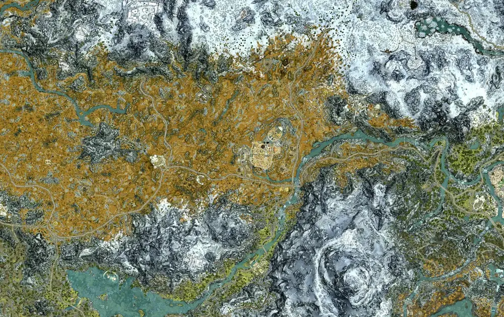
Skyrim Map is a free interactive Skyrim map covering the whole province and the Dragonborn island of Solstheim. It plots more than 1,000 places on a zoomable, top-down map of the game world: all nine hold capitals, every town and farm, caves, Nordic and Dwemer ruins, forts, mines, shrines, standing stones, word walls and the services you need between quests. Open the Skyrim map, type a name into the search box, and the map flies straight to it.
A Skyrim map with all locations in one place
Most people search for a Skyrim map with all locations because the in-game map only shows what they have already discovered. This map shows everything from the start. Locations are grouped by type so you can hide the noise and see only what you are hunting for, whether that is every Nordic ruin in The Rift or every blacksmith between Riverwood and Solitude. Each marker opens a short card with what the place is, which hold it belongs to, who or what lives there, notable loot, and a link to the full UESP article for the walkthrough.
If you prefer to browse by region, every hold has its own page listing its Skyrim map locations by category, starting with Whiterun Hold, The Rift and Eastmarch. Individual places such as Fort Amol in Eastmarch also have their own page, with a pin on the map and a list of the nearest locations around them.
Skyrim map key: what the markers mean
The Skyrim map key on this site uses five colours so you can read the map at a glance. Gold markers are settlements, from cities to lone farmhouses. Blue markers are dungeons and wilderness sites such as caves, ruins, forts, mines and dragon lairs. Purple markers are sacred places: word walls, standing stones, shrines and temples. Coral markers are collectibles, including dragon priest masks, Stones of Barenziah, skill books and treasure maps. Green markers are services such as blacksmiths, alchemists, general stores and carriages. When you mark a location as found, its marker fades, so the map always shows what is left to do.
Every icon in the filter panel doubles as a legend entry. Toggle a single category, a whole group, or use Hide found to strip completed Skyrim map markers away as you play.
Skyrim map with roads, and how it compares to the in-game map
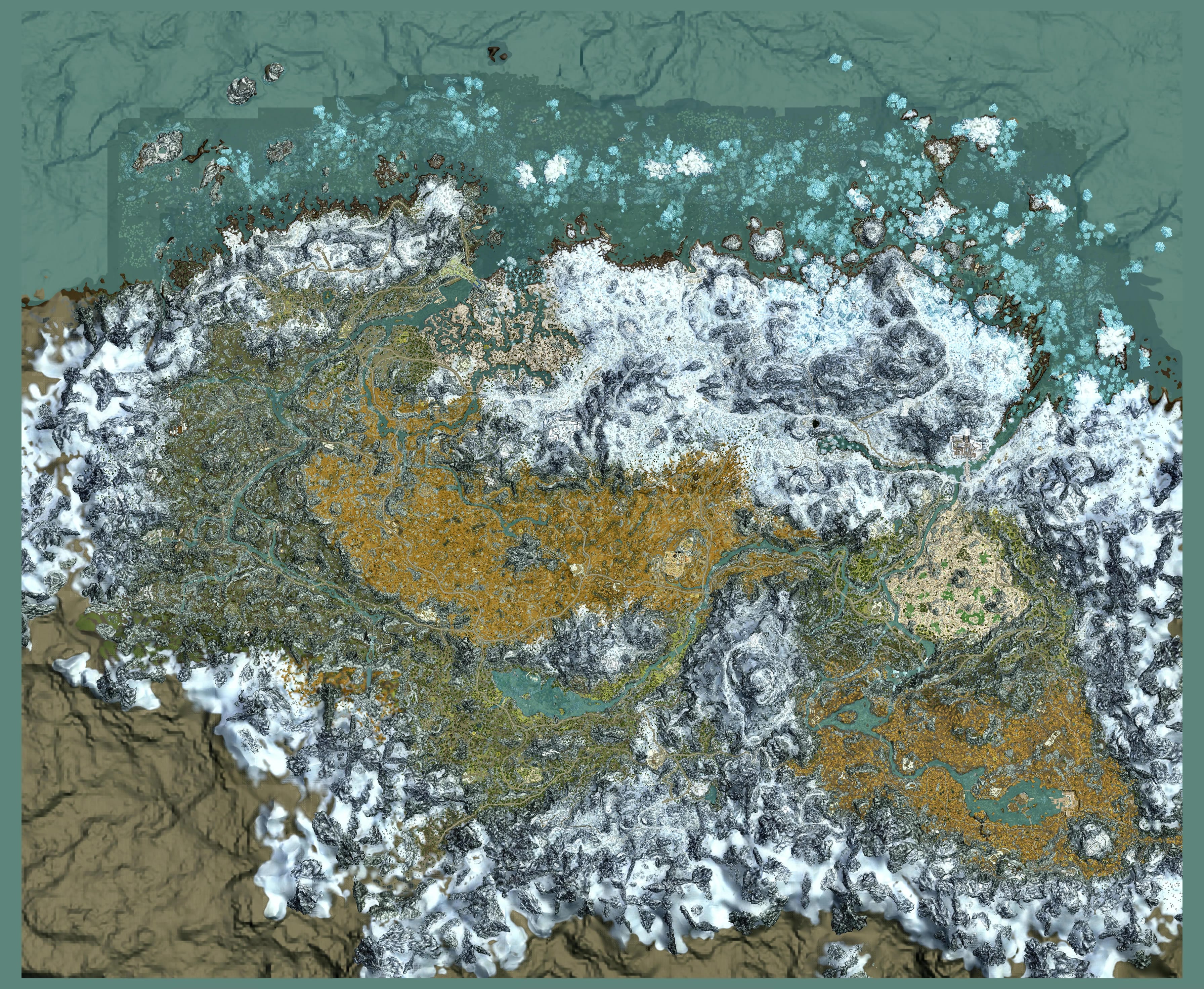
The base layer is a detailed top-down render of the game world, so this is a genuine Skyrim map with roads: you can trace the stone roads between cities, the rivers you can follow on foot, and the mountain passes that the in-game paper map blurs out. The Skyrim map in game, opened with the M key on PC or the map button on console, is a stylised 3D view that hides undiscovered places and lets you drop only one custom marker at a time. Here you can see every location before you find it, share a link to an exact spot, and plan a route across several holds in one go.
How big is the Skyrim map?
How big is the Skyrim map? The playable province covers roughly 37 square kilometres, about 14 to 15 square miles, and measures close to five kilometres from edge to edge. Running from Riften to Solitude without fast travel takes roughly 45 to 50 minutes of real time, and walking the same route takes around two and a half hours. That Skyrim map size surprises people because the world feels far larger. Mountains, valleys and hand-placed dungeons pack a huge amount into a modest footprint, and the Throat of the World alone takes several minutes to climb.
On Oblivion vs Skyrim map size, the numbers are closer than most players expect. Cyrodiil in Oblivion is usually measured at around 41 square kilometres, so its flat area is slightly larger than Skyrim's. Skyrim's terrain is far more vertical, though, and its locations are placed more densely, which is why it feels bigger when you actually travel through it.
Solstheim and other Skyrim map expansions
The largest Skyrim map expansion is Solstheim, added by the Dragonborn DLC. It is a separate island reached by boat from the Windhelm docks, with Raven Rock, Tel Mithryn, the Skaal Village, seven Black Books and 30 East Empire pendants. The Solstheim Skyrim map has its own filters and progress tracker. Dawnguard adds Fort Dawnguard, Castle Volkihar and the Forgotten Vale, and Hearthfire adds three buildable homesteads, one each in Falkreath Hold, Hjaalmarch and The Pale.
Blackreach, the Forgotten Vale and other hidden areas
Some of the most searched places sit underground or behind another location. The Blackreach Skyrim map pin marks the vast Dwemer cavern beneath the north of the province, reached through the Great Lifts at Alftand, Mzinchaleft and Raldbthar. It holds the Tower of Mzark, the Elder Scroll and the only crimson nirnroot in the game. The Forgotten Vale Skyrim map pin marks the hidden glacial valley you reach through Darkfall Cave during the Dawnguard quest Touching the Sky, home to Auriel's Bow and a Drain Vitality word wall.
Track every collectible for 100% completion
Word walls, dragon priest masks, Stones of Barenziah, standing stones and Black Books each have a checklist page that shares progress with the map. Tick a word wall on the list and its pin fades on the map, and the other way round. Progress is saved in your browser with no account and no cap on how many markers you track. You can export it to a file and import it on another device.
Printable Skyrim map poster
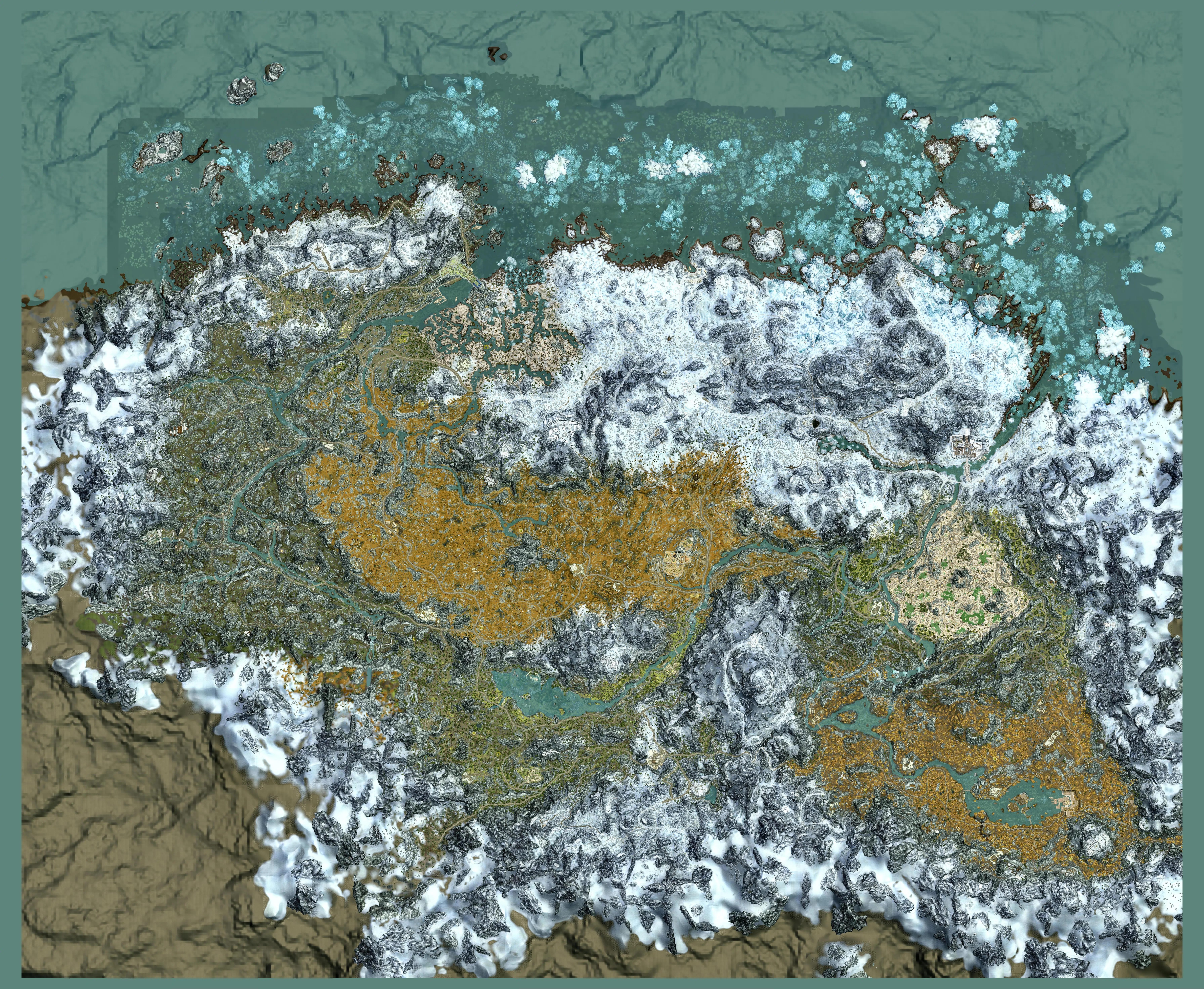
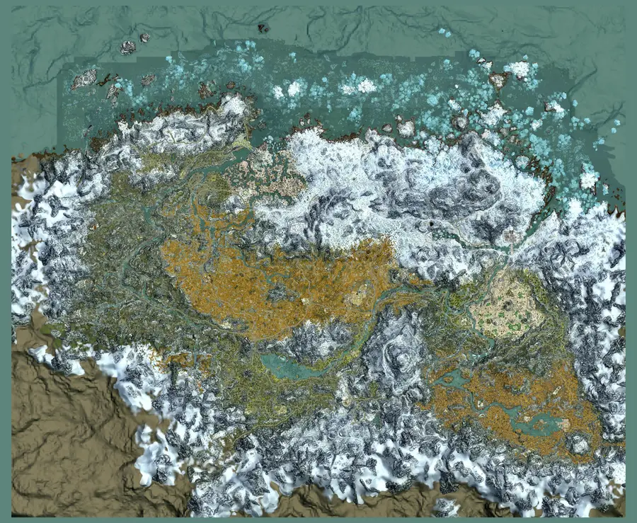
Want a Skyrim map poster for the wall or a second screen? Download the full top-down map as a single high-resolution image: full size, 7168 x 5888 pixels (8.6 MB), which prints cleanly at about 24 x 20 inches, or a lighter 3584 pixel version (2.5 MB) for screens and smaller prints. The imagery comes from UESP under a Creative Commons BY-SA licence, so credit UESP if you share it.
An alternative to Map Genie
Players who used the Skyrim Map Genie map often want the same features without an account or a limit on tracked markers. This map offers filters, search, shareable links and unlimited progress tracking for free, loads quickly on phones, and is available in nine languages.
Where the data comes from
Location coordinates and map imagery are adapted from the Unofficial Elder Scrolls Pages, the community wiki that has documented the series since 1995, under the Creative Commons BY-SA licence. Descriptions and translations on this site are our own. Marker positions are checked against the map imagery, and if you spot something wrong, tell us and we will fix it.
Skyrim map questions
How big is the Skyrim map?
The playable province of Skyrim covers roughly 37 square kilometres, about 14 to 15 square miles, and is close to five kilometres across. It is smaller than many modern open worlds on paper, but mountains, valleys and densely placed dungeons make it feel much larger.
Oblivion vs Skyrim map size: which is bigger?
By flat area Oblivion is slightly larger, at around 41 square kilometres for Cyrodiil against about 37 for Skyrim. Skyrim feels bigger because its terrain is far more vertical and its locations are packed more densely.
How long does it take to cross the map in Skyrim?
Running from one corner of Skyrim to the other, for example Riften to Solitude, takes roughly 45 to 50 minutes of real time. At walking speed the same trip takes around two and a half hours. Horses, carriages and fast travel cut that down sharply.
How does fast travel work in Skyrim?
Open the map and select any location you have already discovered to travel there instantly; time passes as if you had walked. You cannot fast travel while enemies are nearby, while overencumbered or indoors in most places. Carriages outside the hold capitals can take you to cities you have not discovered yet.
Is the Fallout 4 map bigger than Skyrim?
No. Most measurements put Skyrim's playable land at a little under 15 square miles and the Commonwealth in Fallout 4 somewhat smaller, although estimates vary with how water and map edges are counted. Fallout 4 packs more buildings and interiors into its space, so it can feel just as large.
How big is the Crimson Desert map compared to Skyrim?
Much bigger. Pearl Abyss has said the world of Crimson Desert is at least twice the size of Skyrim's playable area, and player estimates after release put it at several times Skyrim's roughly 37 square kilometres.
Is there a Skyrim map with all locations?
Yes. This interactive Skyrim map shows more than 1,000 locations from the start, including every city, town, dungeon, word wall, standing stone and service, so you do not have to discover a place before you can see it.
What does the Skyrim map key mean?
Gold markers are settlements, blue are dungeons and wilderness sites, purple are word walls, standing stones and shrines, coral are collectibles, and green are services such as blacksmiths and alchemists. A faded marker is one you have marked as found.
Does this Skyrim map show roads?
Yes. The map is a detailed top-down render of the game world, so the stone roads between cities, rivers and mountain passes are all visible at every zoom level.
Where is Blackreach on the Skyrim map?
Blackreach is a vast underground Dwemer cavern beneath northern Skyrim, so it has no surface entrance of its own. To find it on the map, look for the Great Lifts at Alftand in Winterhold, Mzinchaleft in Hjaalmarch and Raldbthar in The Pale; each lift takes you down into Blackreach.
Where is Treasure Map III in Skyrim?
Treasure Map III is found in Riverside Shack in Eastmarch, west of Kynesgrove on the river south-west of Windhelm. The map points to a buried chest just north-north-east of Solitude Lighthouse in Haafingar. Turn on the Treasure Map filter to see both spots.
Where is the old well on the Skyrim map?
The old well from the quest The Unquiet Dead is just south-east of Goldenhills Plantation in Whiterun Hold, on the way towards Gjukar's Monument, and is usually guarded by wolves. The quest comes from the Farming Creation Club content included with the Anniversary Edition.
Where is Rin in Skyrim?
Rin is the missing son of the family at Goldenhills Plantation in Whiterun Hold. His remains and his wooden sword are at the old well south-east of the plantation. Returning the sword to his room in the plantation house during The Unquiet Dead lets his spirit rest.
Where is Arvak's Skull in the Soul Cairn?
Arvak's Skull lies east of the Boneyard in the Soul Cairn, beside a tower where four kneeling ghosts rise as Mistmen when you approach. Bring it back to the soul calling for Arvak near the entrance and you learn Summon Arvak, a spectral horse you can use in Skyrim too.
How do you remove a marker from the Skyrim map?
Open the in-game map, move the cursor over your custom marker and select it again: click it on PC, or press the same button you used to place it on console. Placing a new custom marker also moves the old one. Quest markers disappear when you set the quest inactive in your journal.
How do you reveal the whole map in Skyrim?
On PC you can open the console with the tilde key and type tmm 1 to show every map marker, then tmm 0 to hide them again. There is no console on Xbox or PlayStation. Alternatively, this interactive map shows every location from the start without changing your save.
Where is High Gate Ruins on the Skyrim map?
High Gate Ruins sits on the northern coast of The Pale, west of Dawnstar and north-east of Morthal. The dragon priest Vokun waits inside with his mask, and the word wall teaches part of Storm Call.
Where is Raven Rock on the Skyrim map?
Raven Rock is not on the Skyrim mainland. It is the main town of Solstheim, on the island's southern coast, reached by boat from the Windhelm docks once you own the Dragonborn DLC. Open the Solstheim map to see it.
Where is Sunderstone Gorge on the Skyrim map?
Sunderstone Gorge is in the western part of Falkreath Hold, north-west of the town of Falkreath. The cave holds a Fire Breath word wall and one of the 24 Stones of Barenziah.
Where is Tamriel on the Skyrim map?
Tamriel is the whole continent, and Skyrim is its northernmost province, so Tamriel as a whole is not shown on the Skyrim map. Skyrim borders High Rock to the west, Cyrodiil to the south and Morrowind to the east, with Solstheim offshore to the north-east.
How do I get to the Forgotten Vale?
The Forgotten Vale is reached through Darkfall Cave during the Dawnguard quest Touching the Sky. Search Forgotten Vale on the map to find the valley and the cave entrance.
Where is Fort Amol on the Skyrim map?
Fort Amol is a fort in Eastmarch, the hold ruled from Windhelm. Depending on your progress in the Civil War it is held by Imperial or Stormcloak soldiers. Search Fort Amol on the map to jump to it.
Is there a Solstheim map and other Skyrim map expansions?
Yes. Solstheim from the Dragonborn DLC has its own interactive map with Raven Rock, the Black Books and East Empire pendants. Dawnguard locations such as Fort Dawnguard, Castle Volkihar and the Forgotten Vale, and the Hearthfire homesteads, are on the main Skyrim map.
Can I download a Skyrim map poster?
Yes. The full top-down Skyrim map is a free download at 7168 by 5888 pixels, sharp enough to print at about 24 by 20 inches, plus a lighter 3584 pixel version. The imagery is CC BY-SA, so credit UESP if you share it.
How is this different from the Skyrim map in game?
The in-game map, opened with M on PC, hides undiscovered places and allows one custom marker at a time. This map shows every location upfront, lets you filter by type, search by name, share a link to an exact spot and track your progress.
Where are all the word walls?
Turn on the Word Wall filter to see every word wall in Skyrim and on Solstheim, or open the word wall checklist, which lists the shout and word each wall teaches.
How do I find all Stones of Barenziah?
Twenty-four Stones of Barenziah are hidden in cities, dungeons and homes. Use the Stone of Barenziah filter or checklist; each pin explains exactly where the gem sits inside the location.
Is this a free alternative to Skyrim Map Genie?
Yes. It is completely free, needs no account and has no limit on how many markers you can track. Progress is saved in your browser and can be exported to another device.